
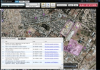
Geosemble Release Integrates Social Media with the Latest Satellite Imagery
Geosemble’s newest software release allows users to find relevant location information from social media and news and display it on the latest satellite imagery. - May 11, 2012

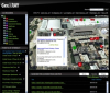
MDA, Geosemble Integrate Tools for Satellite Imagery
The efficiency initiative allows for increased time dedicated to analyzing imagery and intelligence by automating search and discovery. - March 19, 2012
Geosemble, BAE Systems Strengthen Product Integration
Two companies integrate technology to deliver deeper understanding of geographic regions through database analysis and social media visualization - February 21, 2012

Geosemble’s New “TopicGenius” Combines Topic & Place Search
Geosemble’s newest software release allows users to reduce large datasets by combining filters for places of interest and topics drawn from news, blogs and social media. - February 15, 2012

Geosemble Announces Sixth Year of Double Digit Revenue Growth
Software Company Sees Strong Growth Ahead as Big Data and Budget Challenges combine to favor time-saving, precision-search technology. - January 30, 2012

Geosemble Product Release Showcases “PlaceGenius™” Technology for Location Intelligence
Geosemble’s newest software release showcases “PlaceGenius™” as the underlying technology for delivering knowledge about places from sources all over the world. - October 12, 2011
Geosemble, Podmilsak Group Announce Teaming Agreement
New teaming relationship combines deep user-community knowledge with cutting edge geospatial technology for integrated package for US Government Users - July 20, 2011
Geosemble Debuts New Geographic Content Search & Discovery Software
New functionality for Geosemble’s geographic content discovery software delivers knowledge and insight about geographic places for Government and commercial users. - July 08, 2011

Geosemble and In-Q-Tel Expand Strategic Partnership
Expanded relationship with In-Q-Tel brings new functionality for Geosemble’s geographic search and discovery software in the federal government marketplace. - April 20, 2011

Geosemble Announces Fifth Consecutive Year of Revenue Growth, Staff and Partnerships Expand in 2010
Software Company Sees Strong Growth Ahead as Demand for Deeper and More Precise Geographic Search Grows for Enterprise and Mobile Users. - February 08, 2011

Geosemble, ETI Collaborate on Product Development
Geospatial engineering collaboration improves opportunity identification and risk mitigation for government customers. - October 21, 2010
Geosemble a Standout in DARPA 2010 Success Report
The report highlights Geosemble’s ability to develop and commercialize technology for bringing textual content to geospatial imagery and maps. - September 30, 2010

Geosemble Names New VP of Government Programs
The new position reflects growing demand from government customers for Geosemble’s technology for geographic search and overlaying of text on geospatial imagery and maps. - June 22, 2010
BAE Systems and Geosemble Integrate Geospatial Technologies
Companies to demonstrate an integrated system that highlights BAE Systems’ high-quality image analytics and Geosemble’s text-visualization technology. - April 12, 2010
Geosemble Selected for Phase II DHS Program
Geosemble Technologies, Inc., announced today that it has been selected to support a Phase II program from the Department of Homeland Security (DHS) to gather, integrate and display knowledge from geospatial data that will help support the mission of DHS. As part of a DHS program at the University... - February 18, 2010
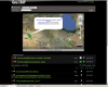
Geosemble to Demonstrate GeoXray Satellite Image Data Integrator at GEOINT 2009
Symposium attendees will experience the power of artificial intelligence in integrating user-definable information -- even tweets and blogs --on a displayed aerial image. - October 15, 2009
Geosemble Wins DARPA Contract for Satellite Image Data Integration
By clicking a given point on an aerial image, GeoXray™ users can view news, video, audio, text documents and other information relevant to a specific location. - October 06, 2009
Geosemble, Fetch Collaborate on Hyperlocal Technologies
Geosemble Technologies announced today a partnership with Fetch Technologies to integrate a wide variety of geotargeted internet information into Geosemble’s GeoXRay precision mapping application. The partnership will enable an unlimited amount of news, event, product and company data to be... - June 09, 2009

Geosemble Secures Strategic Investment from In-Q-Tel
Through a strategic partnership with In-Q-Tel, the independent strategic investment firm that identifies innovative technology solutions to support the mission of the CIA and the broader U.S. Intelligence Community, Geosemble will expand the development of its patented geospatial data integration and layering technology for both the government and commercial markets. - April 14, 2009
Geosemble Technologies Optimizes Its Intellectual Property Portfolio
Carr & Ferrell LLP appointed to transform emerging company Geosemble into an industry-leading enterprise. - March 26, 2009
Geosemble Interactive Map Supports City Redevelopment
The City of El Segundo, California has launched a new online application that allows users to automatically see news for geographic areas being viewed in maps or aerial imagery. The system, known as GeoXray, was developed by El Segundo based Geosemble Technologies for use as an online business and... - March 18, 2009
Geosemble Signs New Board of Advisors Member
A successful innovator and technology start-up veteran joins the “data inside” company for maps and satellite imagery. - February 05, 2009